A flying paradise
Flying like an eagle and enjoying the boundless freedom - that's what our 9 airfields allow. Starting places in all directions and 5 flight schools with highly trained flight instructors, who have the best know-how of the region, fulfill your dream of flying.
Whether you are a pilot or a novice, during a week of flying or a taster course you will remember unforgettable flights around the Dachstein.
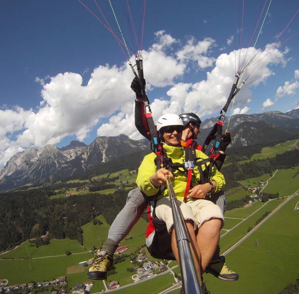
Tandem flying...
...for those who are not pilots themselves but still want to experience the wonderful feeling of free flight. Enjoy the panorama of our holiday region from a bird’s eye view. With an experienced pilot at your side, your dream will become a reality!
Our flight mountains from west to east
- Dachstein - Mit dem Linienbus oder Auto in die Ramsau bis zur Dachsteinbergbahn-Talstation. Von dort geht es mit der Panoramagondel auf den Hunerkogel. Startrichtung: S-SW, Höhe über NN 2.672m.
- Reiteralm – Auffahrt im Sommer mit dem Auto (Mautstraße) dann einstündiger Fußmarsch. Im Winter mit der Gondelbahn Silver Jet und 6er Sessellift danach 20-30 min. Fußmarsch bis zur Gasselhöhe. Startrichtung: W, Höhe über NN 1.914m.
- Hochwurzen – Auffahrt im Sommer mit der Seilbahn von Rohrmoos aus, im Winter mit der Seilbahn von Pichl aus. Startrichtung: O, W-N, H
- Dachstein - By bus or car in the Ramsau up to the Dachsteinbergbahn valley station. From there, take the panoramic gondola to the Hunerkogel. Start direction: S-SW, altitude above sea level 2.672m.
- Reiteralm - driveway in the summer by car (toll road) then one-hour walk. In winter with the gondola lift Silver Jet and 6-seat chairlift then 20-30 min. Hike to the Gasselhöhe. Starting direction: W, altitude above sea level 1.914m.
- Hochwurzen - ascent in summer by cable car from Rohrmoos, in winter by cable car from Pichl. Start direction: O, W-N, altitude above sea level 1,800m.
- Planai - Ascent with the Planai mountain railway, starting direction: OSO-NON, NO-NW, altitude above sea level 1,840 m. Middle station: NNO-NW, altitude above sea level 1,320 m.
- Hauser Kaibling - ascent with the Schladminger Tauern cable car in the village of Haus. Landing place 3 min. to the cable car. Start direction: SW-NW, O-NO, altitude above sea level 1,960 m.
- Stoderzinken - Ride by car or SCA-plane taxi from Landeplatz to Steinerhaus. Start direction: SO-SW, NW-N, altitude above sea level 1,980 m.
- Michaelerberg / Moosheim driveway with the flight school on the Michaelerberg. Start direction: NO, altitude above sea level 1,089 m.
- Riesneralm - Ascent with the chairlift of Donnersbachwald, open from Friday to Monday.
- Rittisberg - Ascent by cable car, starting direction: O, S, altitude above sea level 1,450 m.
Flight schools and providers:
Fight School Aufwind / Tel: +43 (0) 3687 81880 / www.aufwind.at
Flight School Sky Club Austria / Phone: +43 699 12332211 / www.skyclub-austria.at
Air aesthetics / Tel: +43 (0) 660 8877440 / www.airsthetik.at


